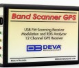
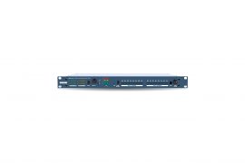
The Band Scanner GPS enables you to evaluate FM broadcast band congestion and to log stations’ identification parameters. This device is a Google Earth compatible tool with a built-in GPS Receiver generating a display of the collected FM Radio measurements. The Log file can be exported as a .kmz file or a transitional format and saved for future analysis.
Pocket-sized and USB-powered, the Band Scanner GPS is the perfect device for field work. This unit can measure RF level, MPX deviation, Left & Right Audio levels, RDS and Pilot injection levels. The measurement results can be easily displayed in Google Earth. The band scan range is from 87 to 108 MHz. The supplied – free of charge – Windows software sweeps the receiver across the FM band, logging every carrier and generating a spectrum display of carrier level vs. frequency. It then analyzes each carrier and creates a station list.
Main Features:
• FM Band 87 – 108 MHz Spectrum analyzer
• MPX, PILOT & RDS deviation meters
• Built-in Stereo decoder; LEFT and RIGHT level meters
• Built-in 12-channels GPS Receiver
• Measurement results visualisation in Google Earth
• Auto search tuning
• Headphones audio output
• Full feature RDS and RBDS decoder
• RDS/RBDS Groups Detector & Analyzer
• RDS/RBDS Stream BER meter
• FM/RDS/RBDS Data Logger
• View playlists of the competitive stations
• Saving and exporting the playlists to Excel file
• Compare the signal strength to competitors and other stations
• Pocket size USB powered box. No external power supply required
• Tracking all the detailed histories saved in the RDS Data Log
• TCP/IP Remote management and control via Internet
• Remote audio listening and logging via Internet
Specifications:
FM receiver:
• FM frequency 87.0-108.0 MHz
• RDS sensitivity 0 error at Vrf=-90dBµV, 4KHz RDS deviation, no modulation
Strong fields AGC:
• RF level evaluation ± 4dB from 20°C to 30°C, 20÷60dBµV without modulation
• Dynamic 0 to 54.6dBµV; 0 to 60dBµV with internal attenuator switched on
• Attenuator 6dB built-in, manual operation Audio, MPX, Pilot,
RDS levels:
• Measurement validity RF level preferably > 50dB
• Multiplex level Peak level displayed, 1000 samples over 1 second
• Audio level Peak level displayed, 1000 samples over 1 second
• Pilot level Mean peak level, 1000 samples over 1 second
• RDS level Mean peak level, 1000 samples over 1 second
• Accuracy of MPX deviation display ± 5KHz, ± 2KHz typ
• Accuracy of audio level display ± 5%
• Accuracy of sub-carrier level displays ± 10% typical and not guaranteed FM
Antenna input:
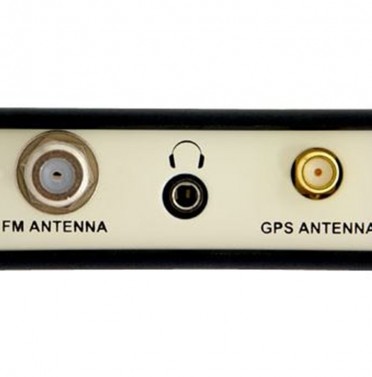
• Connector ‘F’ on rear panel
• Impedance 75 Ω
• External attenuator No
Stereo decoding:
• Stereo separation >20dB
• Typical separation Approximately 26dB to 35dB
RDS data decoding:
• Standards European RDS CENELEC and United States RBDS NRSC
• Error Correction Yes
• Group counting Yes
• Error counting Yes
• AF decoding Yes
• CT (Time/Date) Yes
• PI, PTY, DI, MS Yes
• TA/TP Yes
• RT (Radio Text) Yes
• PS (Program Service name) Yes
• EON (Enhanced Other Networks information) Yes
• PTYN (Program TYpe Name) Yes
• SLC (Slow labelling Codes) Yes
• ODA (Open Data Applications) Yes GPS receiver:
• Number of channels 12
• Antenna Pre-amplified, 5m of cable, magnetic
• Connector SMA, rear panel
Frequency program memories:
• GPS Scheduler Capacity 50 frequencies F
• Tuner Presets 5 frequencies
Measurement storage:
• Storage LOG file
• ata formats Microsoft Excel compatible format (csv), Google Earth compatible KMZ
User interface:
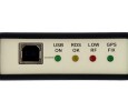
• Indicators 4 LEDs, front panel
• Headphone output 1/8″ (3.5mm) phone jack, rear panel
• Equipment operational between 10° and 40°C
• EMC immunity 6V/m
Headphones output:
• Connector Stereo, 1/8″ (3.5mm) phone jack
• Volume Fixed
Communication:
• Type USB 2.0 compatible
• Connector B-type, front panel
• Power supply USB powered
• Connector B-type, front panel
• Dimensions (W x H x D) 2.9″ x 1″ x 4.3″
• Weight 2 lbs


